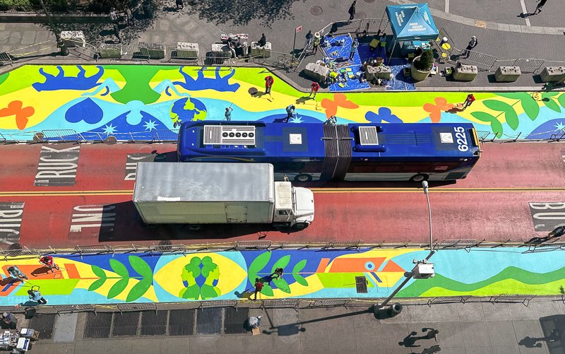
Livable streets
Glossary
A
all ages and abilities
This design and planning approach prioritizes building infrastructure like bike lanes, sidewalks, curblanes that is accessible to a wide range of needs and serves the full spectrum of ages and abilities.
armadillos
Armadillos are the name for raised bumps, usually made of recycled plastic, placed in intervals along the edge of a bike lane to protect cyclists. The benefit to using these, rather than a high continuous barrier, is that cyclists can enter and exit the lane.
See also “paint (is not protection!)”
automated enforcement
The use of cameras or sensors to automatically, and without bias, enforce traffic laws or street regulations. New York City uses automated enforcement for some speeding, red-light violations, and bus lane violations. This technology could also be expanded to help curb dangerous and harmful violations in loading zones, bike lanes, daylit spots and more.
B
Barnes dance
Also called a pedestrian interval; a type of pedestrian crossing system at intersections where all vehicle traffic stops at the same time, allowing pedestrians to cross in all directions, including diagonally, without any moving vehicles in the area.
BID (Business Improvement District)
These local organizations provide business and street services to a specific area, funded through dues paid by property owners. BIDs often manage sanitation, street lighting, street design improvements, and public space. In New York, BIDs range from the highly resourced Time Square BID to much smaller organizations in residential neighborhoods. They often provide the only public space management in a district.
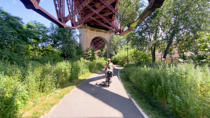
bike boulevard
A route designed specifically to encourage safe and comfortable bicycle use, usually by diverting motor vehicles off the main street while allowing bikes to continue along its path.
Photo by Rock Miller via Momentum Mag
bike bus
A community-led group of cyclists who travel together from one point to another on a planned route. Bike buses are typically organized to provide safe cycling in urban areas and are often used to bike younger children to and from school.
Photo by Jackson Chabot, Open Plans
bike corral
An area designated for parking bicycles. Corrals are an important amenity for encouraging cycling and are typically installed in street space - either in the curblane or along a section of a protected bike lane.
bioswale
Similar to rain gardens, bioswales are street or sidewalk plantings that manage stormwater by slowing the flow of water. They help prevent flooding and add greenery to the streetscape.
See also "rain gardens"
block association
These organizations do some of the same work as a BID but in an informal, less structured way. Often made up of local residents or property owners, they focus on a specific block or section of neighborhood and typically address local issues like plantings, trash removal, rodent mitigation and public safety.
bollard
A short post or pillar used to direct the flow of traffic, secure pedestrian areas, protect daylighting or otherwise delineate public space.
built environment
The built environment refers to our human-made physical surroundings, including buildings, streets, parks, and infrastructure, that form the backdrop and setting for daily life.
bulb-out
A sidewalk extension that protrudes into the street, usually at an intersection. Bulb-outs improve pedestrian visibility, shorten crossing distances, and help slow traffic. Also called a neckdown.
Photo by Suffolk County New York Government
busway
Busways are dedicated routes or corridors that are separated from other vehicle traffic and provide fast and efficient transit service.
Photo by Angel Mendoza, Open Plans
C
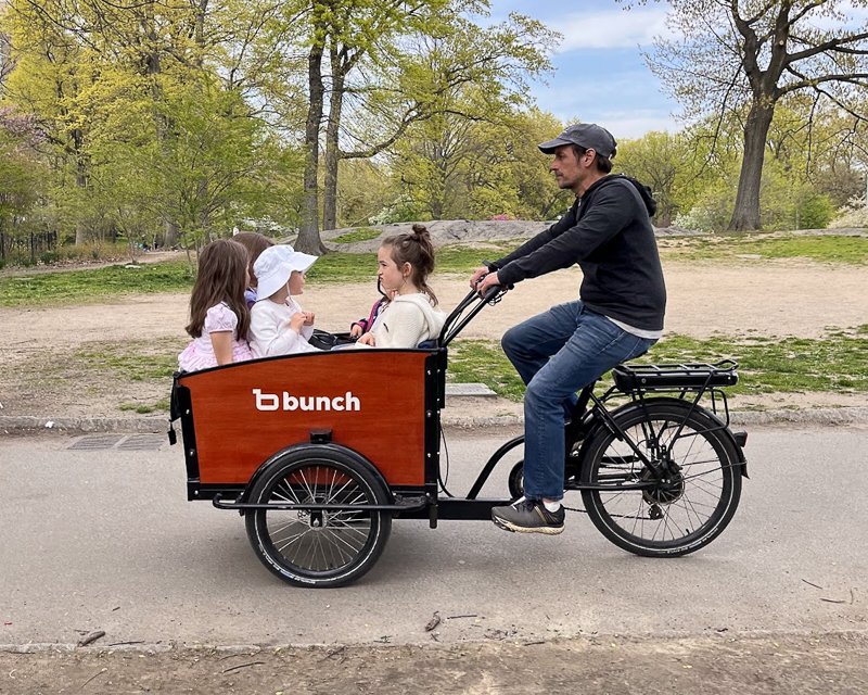
cargo bike
These bicycles are designed especially to allow for easy transportation of goods, cargo and passengers. Cargo bikes are capable of replacing the function of many more car trips than a traditional bike.
carshare
A system that faciltates access to shared vehicles for short-term use. In 2022, 24% users of the car-share service Zipcar were able to get rid of their private car after joining.
Photo by Chelsea Dowell, Open Plans
chicane
A type of street design element that manipulates the roadway into a series of alternating curves or obstructions, helping to slow vehicle traffic and improve safety.
Photo by New York City Department of Transportation
community board
Community boards are advisory bodies made up of local representatives who address neighborhood issues and provide input on various city matters. Members are appointed by the Borough President and may serve up to four two-year terms. Open Plans works directly with community boards to ensure they are demographically representative of the districts they serve and educated on issues impacting the livability of their streets.
containerized trash
A waste management system where trash is collected and transported in closed containers. When implemented in the curblane, containerization makes it easier to use the sidewalk and easier for sanitation workers to collect.
Photo by Carl Mahaney, Open Plans
corridor
A linear area or pathway, often along a street or transportation route. Corridors connect various locations and may have specific and unique identifiers related to demographics, usage, culture, or more.
crash, not accident
A reminder that traffic violence is not an accident! Vehicle crashes are the result of specific behaviors and factors, like road design, that can be prevented or mitigated.
curb reform
Curb reform aims to redesign, repurpose, and rethink the use of curbside spaces to better serve the needs of a broad group of users, including pedestrians, cyclists, mobility, freight, and more.
D
daylighting
Daylighting makes intersections much safer by prohibiting parking directly adjacent to a crosswalk. The vast majority of crashes occur at intersections, so increasing visibility for pedestrians and drivers makes intersections much safer. Daylighting is most effective when hardened with bollards, bike corrals, boulders or other amenities.
Photo by Chelsea Dowell, Open Plans
Department of City Planning (DCP)
The Department of City Planning is the government agency responsible for urban planning and development oversight, including land use, development, and zoning.
Deliveristas
Deliveristas is the collective name given to people who work as independent food deliverers in New York City. They often use bicycles or scooters and work for food delivery apps.
Photo by the Worker’s Justice Project
density
The measure of the number of people or things - residents, homes, businesses, transit modes - within a given area. Dense neighborhoods are more walkable, connected, and climate friendly.
Department of Transportation (DOT)
The Department of Transportation is the government agency responsible for overseeing transportation infrastructure and operations. In New York City, DOT manages the roadway and all activations of it, including Open Streets, as well as bike lanes and curbside uses like the Open Restaurants program.
digital curb
A technology tool that uses data to manage and allocate curbside spaces within a uses data to manage and allocate curbside spaces for various uses, including parking, deliveries, and pick-up/drop-off zones. Omaha, Nebraska uses this technology to easily implement new curb policies and manage initiatives like metered parking at strategic locations.
Image by Hoboken, NJ Department of Transportation & Parking
Dining Out NYC
A New York City program that allows restaurants and bars to utilize the curb space in front of their establishment as part of their business. Started in response to the COVID-19 pandemic, a permanent seasonal program was passed in 2023
Photo by Angel Mendoza, Open Plans
double-wide bike way
These bike lanes are wide enough to accommodate two cyclists riding side-by-side. The increased width dramatically increases safety and accessibility by allowing more space for users of all speeds and abilities.
Photo by New York City Department of Transportation
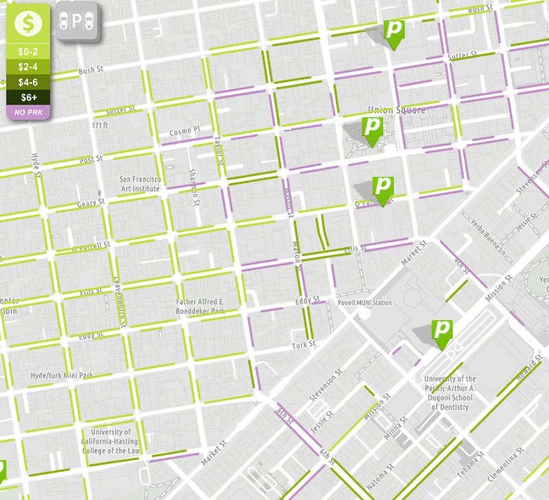
dynamic pricing
This strategy adjusts curbside parking pricing in real time, based on demand or other factors, to align the price of parking with its market value.
Image by San Francisco Municipal Transportation Agency
E
e-bike
A bicycle that uses a battery to assist the rider; they are legally permitted to be used in bike lanes. E-bikes come in three classes: Class 1 bikes use pedal-assist technology and reach 20mph. Class 2 bikes also reach 20mph but do not require pedaling and instead operate using a throttle. Class 3 e-bikes use a throttle and top out at 25mph.
e-micromobility
Devices including bikes, scooters, skateboards, and unicycles, that are powered by a battery. These devices make it easier, faster, and more accessible to use micromobility, and their extra speed and power have made them useful for transporting heavier loads and travelling farther distances. In recent years, the popularity of e-micromobility has transformed New York City's transportation landscape and especially the food delivery industry.
Photo by Bird Bikeshare
enforcement
Enforcement is a nuanced but crucial part of transportation and urban planning. Proper enforcement ensures that roadways or amenities function as intended and also sets expectations for appropriate use or behavior on a street.
environmental justice
The concept of ensuring that all communities, regardless of race or income, have equal access to needed environmental protections and safe surroundings. Typically used to refer to focusing investment on areas of cities that have been historically marginalized.
environmental review (CEQR, SEQRA, etc)
These government processes regulate and assess the environmental impact of a proposed project or development. Nearly all land use projects that involve a rezoning must undergo one or more of these reviews.
equity
The principle of distributing resources proportionally, according to the greatest need. In livability practices, this could apply to focusing a large share of projects, resources, or amentities in traditionally marginalized neighborhoods, focusing on concetrated impact in areas where it's needed most.
F
fifteen-minute city
This urban planning concept aims to create neighborhoods where residents can access most of their daily needs within a 15-minute walk or bike ride from their homes.
flex zone
Flez zones are urban spaces, often at the curb, that can adapt to various uses and activities throughout the day, according to demand. They often temporarily repurpose a parking spot for another use for a designated period of time.
fun
An essential part of urban design and planning! Public spaces should be designed and programmed to encourage fun and enjoyment.
Photo by Jim Burke, 34th Avenue Open Streets
G
greenway
These linear paths often follow a natural feature, like waterfront, and combine park-like features with designated space for walking, cycling, and other active mobility.
Photo by Clarence Eckerson Jr., Streetfilms
gridlock
Severe traffic congestion, often caused by car-centric infrastructure and a car-first mentality, that hurts all road users and contributes to the climate crisis through increased emissions.
H
Heat Island Effect
A phenomenon that occurs in urban areas when abundant paved surfaces combine with vehicle emissions and high building density to trap solar heat, leading to higher temperatures. This can exacerbate the impacts of climate change and should be mitigated by deprioritizing paved spaces and boosting shade cover in public spaces.
high comfort bike lanes
Micromobility lanes designed with safety and comfort at the fore. These lanes are often wide, physically separated from vehicle traffic, and designed for leisure and enjoyment.
homerule
The authority of local municipalities to make decisions and govern themselves without interference or approval from higher levels of government. In many aspects of streets and curbs, New York City does not have homerule, which impacts the City's ability to lower speed limits and use some automated enforcement tools.
I
indemnity
Indemnity is legal assurance provided to individuals or organizations to protect them from financial or other burdens. On New York City's Open Streets, organizers must indemnify the city for accidents and injuries that occur during an event. This forces community organizers to take on the significant burden of insurance coverage, which creates an equity gap for public space.
induced demand
The phenomenon where the expansion of transportion infrastructure (i.e. adding lanes to a highway) causes users to flock to that infrastructure, resulting in an increase in usage - creating more congestion rather than reducing it.
J
jersey barrier
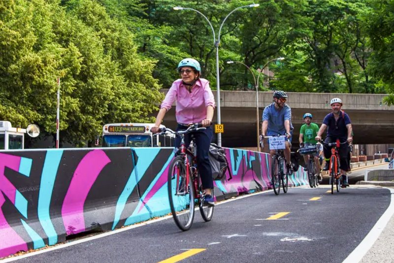
Typically made of concrete or weighted plastic, this type of bike lane barrier offers much more protection to cyclists than paint or a flexible bollard.
Photo by New York City Department of Transportation
K
kick scooter
A stand-up scooter without a battery that must be propelled by human action; often used by kids to get around a neighborhood.
Photo by Swifty Scooters
Killed or Seriously Injured (KSI)
KSI is a metric used in traffic safety analysis to identify locations or corridors where individuals are more or less likely to experience traffic violence. Many DOTs use this metric for street improvement plans but it is retroactive, in that action is only taken once a preventable injury or death has already occured.
L
Leading Pedestrian Intervals (LPI)
These traffic signal timing features improve safety by giving pedestrians a head start to enter an intersection before adjacent vehicular traffic gets a green light. They are a light-touch intervention to make intersections safer.
Level of Service
A qualitative tool to describe how well a street operates based on factors such as speed, travel time, delays, etc; it prioritizes the movement of vehicles over the experience and safety of all other road users.
livability
The degree to which a neighborhood or city is good for living, prioritizing physical and mental wellbeing, accessibility, safety, community, mobility, agency and independence.
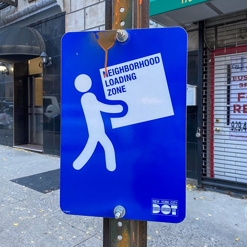
loading zone
A designated area along a curb where vehicles can temporarily stop to load or unload goods or passengers. This space reduces double parking and blocked bus lanes, bike lanes, and crosswalks.
Photo by Angel Mendoza, Open Plans
low-traffic street
A roadway designed to accommodate minimal vehicle traffic, often prioritizing pedestrian and cyclist safety.
M
median
The raised strip of curb that separates opposing lanes of traffic on a (usually) wide roadway. They are sometimes landscaped and can provide a safe space for pedestrians to wait while crossing.
Photo by New York City Department of Transportation
micromobility
The term for the group of transportation modes that include small, lightweight vehicles like bikes, e-bikes, scooters or skateboards.
Image by Joyride
mode shift
The concept of shifting away from one predominant transportation mode (driving) to another (walking, biking, public transit). Pursuing mode shift is an important goal in making communities safer, more livable and more climate friendly.
moped
Mopeds are sit-down, motorized bikes that require a license to operate. They can powered by either battery or gas and are not permitted to be used in bike lanes. There are three classes of mopeds, which are capable of reaching speeds from 20 to 30mph.
O
Open Street
A New York City program that allows communities to use their street for programming and other people-centered uses, closing the street to vehicular traffic. Started in response to the COVID-19 pandemic, Open Streets are run by members of the community and have become a popular fixture in many neighborhoods.
Photo by Street Lab
outdoor dining
See "Dining Out NYC"
Photo by Angel Mendoza, Open Plans
P
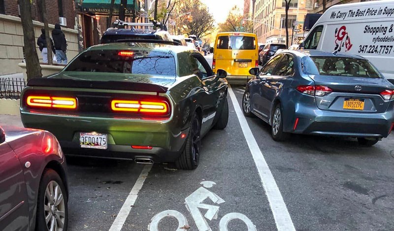
paint (is not protection!)
A slogan emphasizing that painted lanes or markings do not provide sufficient safety for cyclists. Data shows that bike lanes designated only with paint are as safe or even less safe than biking on streets with no bike lane at all.
Photo by Carl Mahaney, Open Plans
parking benefit districts
Areas of a city where revenue generated from paid street parking is reinvested in the local community for public space improvements and services.
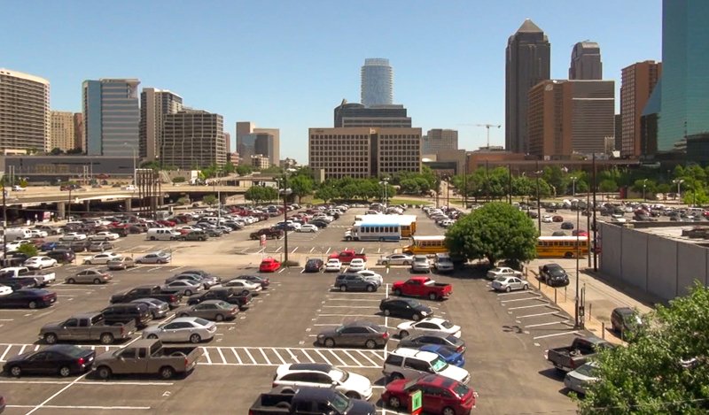
parking craters
Gaps in the streetscape created by large, underutilized parking lots or structures that deaden the streetscape, preclude groundfloor retail or residences, create sprawl and make streets less livable.
parking mandates
Parking mandates (or parking minimums) force new developments to include off-street parking regardless of demand or desire. These outdated zoning rules increase the cost of housing, decrease housing production, and contribute to a vicious cycle of car dependence. Open Plans is leading a campaign to lift these mandates in 2024.
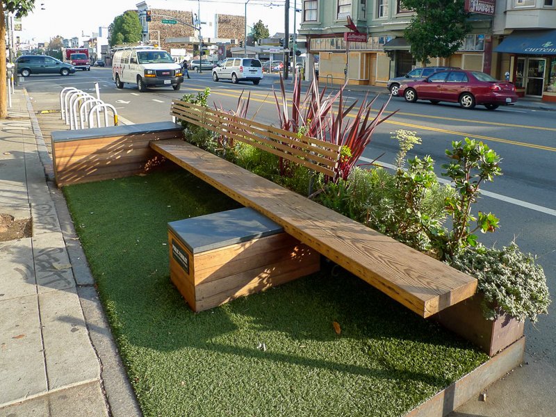
parklet
A small seating area or green space, often used to refer to space that has been reclaimed from curbside parking or other non-public space.
Photo by SFParklet
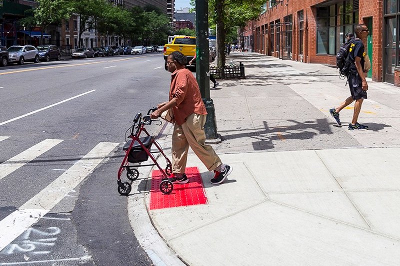
pedestrian ramp
A sloped or lower section of a raised curb that facilitates movement between the sidewalk to the roadway; usually at street corners and particularly important for people using wheeled devices including wheelchairs and strollers.
Photo by New York City Department of Transportation
people-first design
An urban planning approach that considers the needs, wellbeing, and safety of people over vehicular traffic.
placard abuse
The misuse or fraudulent use of official parking permits, often by parking illegally or dangerously on the sidewalk or in undesignated spaces.
Photo by Streetsblog
placemaking
Placemaking is a process and a school of thought that approaches public space from a people-first perspective, designing and managing public spaces with intention to create holistic places for community. Placemaking considers functionality, aesthetics, resilience, and site-specificity when planning public space.
plaza
A public square or open space, often designed to be pedestrian friendly and used for rest, gathering, or events.
Photo by New York City Department of Transportation
public space
Any area that is open and accessible to the public. In New York, that means all the places between our buildings where life happens — sidewalks, streets, curbs, parks, and plazas.
Q
quality of life
Overall wellbeing and satisfaction, influenced by factors like health, safety, accessibility, environment, opportunity, support, and other amenities.
R
rain garden
Similar to bioswales, rain gardens are street features that capture and filter stormwater, keeping water supply safe and preventing flooding on city streets. They are often placed at curbs and feature native plants.
See also "bioswale"
Photo by New York City Department of Environmental Protection
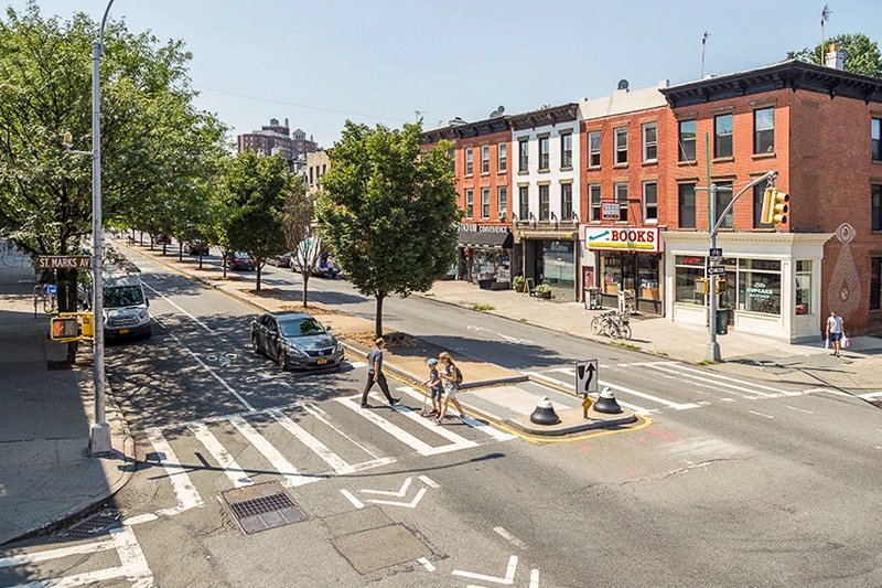
raised crosswalk
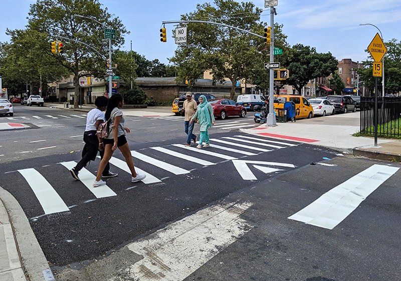
An elevated pedestrian crossing at an intersection, often level with the sidewalk. These crosswalks are designed to slow vehicle traffic and improve visibility by elevating pedestrians above street level.
Photo by New York City Department of Transportation
residential parking permits
These permits allow residents of certain areas exclusive access to on-street parking on designated streets. Intended to alleviate congestion at crowded curbs, this policy still prioritizes low-cost car storage at the curb above all other, more productive, uses.
Photo by Philadelphia Parking Authority
resolutions
Community board members can propose and adopt resolutions related to local issues or concerns. These resolutions can be used to propose or affirm support for projects in a district and serve as letters of support to the appropriate policy or decision maker.
road diet
Road diets are measures taken on a specified corridor meant to reduce and slow the flow of traffic, making the area safer for all users.
S
school streets
School streets temporarily close a block to vehicular traffic to allow schools to use the street for arrival, dismissal, socializing, playing, and learning. In New York City, DOT runs this program, which is open to any public or private school in the city. Open Plans works directly with schools to help them learn about and apply for the program.
Photo by Clarence Eckerson Jr., Streetfilms
scooter
Scooters are small wheeled devices that are operated while standing. Sometimes considered a children’s device, many adult commuters use electric scooters for their daily commutes. Compact enough to be folding when not in use, scooters typically reach around 20mph and are permitted in a bike lane.
sidewalk
A paved, usually raised, pathway along the side of a roadway. In New York City sidewalks are meant for pedestrian use and are part of our public space ecosystem.
Photo by New York City Department of Transportation
sidewalk shed
Temporary structures erected along the sides of buildings for maintenance or repair needs. Although often used by New Yorkers as refuge on a rainy day, they can deaden streetscape and create accessibility issues if they are too intrusive or stay up for too long.
Photo by nyc.gov
sneckdown
This term combines "snow" and "neckdown" to describe the phenomenon that occurs when snowfall reveals the natural patterns of car use on city streets. As cars make tracks in the fallen snow, underutilized roadspace is revealed, highlighting how much road space is designated for cars compared to how much they actually need or use. Sneckdowns offer valuable insights into unused road space that could be allocated for public use, especially curb extensions.
Image by Doug Gordon via Streetsblog Massachusetts
sociospatial
Pertaining to the interaction and relationship between social factors and spatial factors. This concept explores how people and societies interact with, and impact, the built environment and vice versa.
spatial equity
This concept explores how public spaces — sidewalks, streets, parks, and plazas — are designed and designated within cities, with a focus on ensuring that often marginalized communities are prioritized in planning new projects.
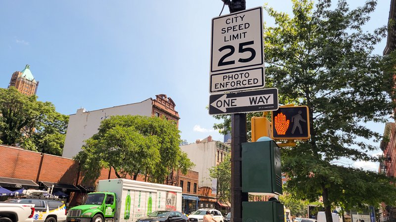
speed cameras
Automated devices that enforce speed limits and issue tickets for drivers that excede the speed limit by 11mph or more. They are proven to change behavior and promote safer driving habits.
speed limiters
Devices that restrict a vehicle's maximum speed, ensuring that no vehicle can reach dangerous and excessive speeds. Similar to DUI breathalyzers, limiters could be installed in the vehicles of repeat offenders to force them to drive at safe, legal speeds.
Street Activity Permit Office (SAPO)
This agency is responsible for issuing permits for all street-related activities and events in New York City.
Street Improvement Project (SIP)
The term DOT uses for a plan or strategy aimed at enhancing the quality, safety, and livability of a designated area of streets.
Photo by Mike Lydon, Street Plans
streetscape
The visual, physical, and social elements that make up a corridor, typically as experienced from a sidewalk. The factors include safety, landscaping, accessibility, lighting, furniture, commerce, architectural features, and more.
Summer Streets
A program in some cities, including New York, where certain streets are temporarily closed to car traffic in the summer months to allow for outdoor activities and community engagement. DOT's Summer Streets have been immensely popular in New York for over a decade and recently expanded to all five boroughs, in part due to our advocacy!
Photo by New York City Department of Transportation
superblock
A larger-than-average city block often made by combining multiple average-sized blocks. Superblocks usually break the standard street grid and are often pedestrian-oriented or feature multiple shared public spaces.
T
tactical urbanism
This is a grassroots approach to planning and design where communities make temporary, quick, and low-cost changes to their environment to test and improve their urban spaces. Typically done without express permission from the city.
Photo by City of Snellville, Georgia
testify
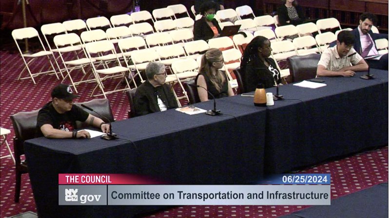
In the concept of urban advocacy and livability, testifying is a way for residents to share their questions or concerns with local leaders on a specific topic or project. In New York City, most changes to our public spaces must go through some process that invites testimony from the public. This testimony is a powerful way to participate in local affairs.
Screenshot from New York City Council
traffic evaporation
The inverse of induced Demand, this is the theory that reducing road capacity, by removing lanes or implementing traffic calming, can decrease overall congestion. When New York City restricted 14th Street to bus travel only, traffic congestion in the area decreased; buses moved more quickly, making them more popular, and overall demand for car travel in the area decreased.
transit
Public transportation systems, including buses, trams, subways, and commuter trains, that are designed to move a high volume of people within and between urban areas.
truffle paint
The term for the brownish grayish paint that NYC DOT frequently uses to designate daylighting, curb extensions, and other safe streets measures. Truffle paint should always be used in conjunction with physical elements - like bollards, planters, boulders or bike corrals - to ensure that the space is properly protected.
Photo by National Association of City Transportation Officials (NACTO)
U
Uniform Land Use Review Procedure (ULURP)
The process for reviewing and approving changes to land use and zoning regulations in New York City. Any proposed project that requires a rezoning must go through this public process before moving forward.
urbanism
A planning and development approach aimed at creating functional, sustainable, productive, and livable urban environments that prioritize human-scale development and design. Urbanism frequently focuses on accessible, climate resilient, and transit rich districts that center livability and wellness.
V
Vehicle Miles Traveled (VMT)
A measure of the total distance traveled by all vehicles within a specific area or time frame. Reducing VMT leads to less traffic violence, more walkable neighborhoods, more transit options, and less polluted air, and is a core goal of Open Plans.
Vision Zero
A traffic safety initiative in many cities that aims to eliminate all traffic-related fatalities and serious injuries through design, enforcement, and education measures. New York City's Vision Zero program was enacted in 2014.
vulnerable road user
Pedestrians, cyclists, and other road users who are especially susceptible to the harmful effects of inhospitable and car-centric street design.
W
walkability
The degree to which an area or neighborhood is conducive to travelling without the need of a bike, a car, or other transportation modes. Walkable neighborhoods include the basic services that a resident needs access to and feature a streetscape that is welcoming for all users.
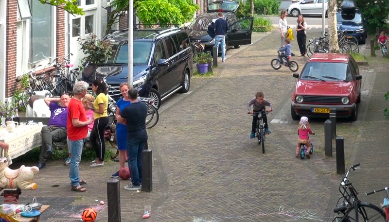
woonerf
This is a Dutch term for a shared, low-speed street or urban space designed to prioritize pedestrians and slow-moving transportation, often with no distinction between sidewalk and roadway.
X
x-crossings
A term used in the UK to describe a streetscape where pedestrian crossings are permitted and safe, similar to a "scramble crossing" in other areas of the world.
Y
YIMBY (Yes In My Backyard)
A movement or ethos that supports housing, development, and land use projects in local communities, often in contrast to NIMBYism.
Z
zebra stripes
Pedestrian crosswalk markings of alternating black and white stripes; used to improve pedestrian visibility and clearly delineate a space for people crossing an intersection. Many cities are also painting their crossings bright colors to beautify the street and create more visibility.
zoning
The process of designating land into different areas of usage, usually with specific regulations governing density, activity, and building types for each specific zone.


